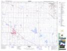
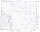
Maps showing Rock Lake, 20-15-W5, Alberta
Rock Lake is a Lake located in 20-15-W5, Alberta and has an elevation of 763 meters.
- Latitude: 50° 40' 50'' North (decimal: 50.6805555)
- Longitude: 111° 59' 17'' West (decimal: -111.9880556)
- Topography Feature Category: Lake
- Geographical Feature: Lake
- Canadian Province/Territory: Alberta
- Elevation: 763 meters
- Location: 20-15-W5
- Atlas of Canada Locator Map: Rock Lake
- GPS Coordinate Locator Map: Rock Lake Lat/Long
Rock Lake NTS Map Sheets