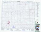
Maps showing Rockyford, 22-26-23-W4, Alberta
Rockyford is a Village located in 22-26-23-W4, Alberta and has an elevation of 845 meters.
- Latitude: 51° 14' 3'' North (decimal: 51.2341666)
- Longitude: 113° 8' 33'' West (decimal: -113.1424999)
- Topography Feature Category: Village
- Geographical Feature: Village
- Canadian Province/Territory: Alberta
- Elevation: 845 meters
- Location: 22-26-23-W4
- Atlas of Canada Locator Map: Rockyford
- GPS Coordinate Locator Map: Rockyford Lat/Long
Rockyford NTS Map Sheets