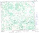
Maps showing Rocky Rapids, 4-50-7-W5, Alberta
Rocky Rapids is a Unincorporated area located in 4-50-7-W5, Alberta and has an elevation of 810 meters.
- Latitude: 53° 16' 47'' North (decimal: 53.2797222)
- Longitude: 114° 57' 6'' West (decimal: -114.9516667)
- Topography Feature Category: Unincorporated area
- Geographical Feature: Hamlet
- Canadian Province/Territory: Alberta
- Elevation: 810 meters
- Location: 4-50-7-W5
- Atlas of Canada Locator Map: Rocky Rapids
- GPS Coordinate Locator Map: Rocky Rapids Lat/Long
Rocky Rapids NTS Map Sheets