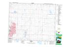
Maps showing Rocky View, 2-26-29-W4, Alberta
Rocky View is a Unincorporated area located in 2-26-29-W4, Alberta and has an elevation of 1091 meters.
- Latitude: 51° 11' 25'' North (decimal: 51.1902777)
- Longitude: 113° 56' 9'' West (decimal: -113.9358332)
- Topography Feature Category: Unincorporated area
- Geographical Feature: Locality
- Canadian Province/Territory: Alberta
- Elevation: 1091 meters
- Location: 2-26-29-W4
- Atlas of Canada Locator Map: Rocky View
- GPS Coordinate Locator Map: Rocky View Lat/Long