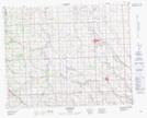
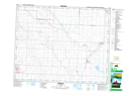
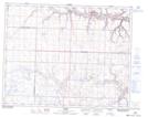
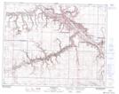
Maps showing Rosebud River, 28-28-19-W4, Alberta
Rosebud River is a River located in 28-28-19-W4, Alberta and has an elevation of 814 meters.
- Latitude: 51° 25' 13'' North (decimal: 51.4202777)
- Longitude: 112° 37' 44'' West (decimal: -112.6288888)
- Topography Feature Category: River
- Geographical Feature: River
- Canadian Province/Territory: Alberta
- Elevation: 814 meters
- Location: 28-28-19-W4
- Atlas of Canada Locator Map: Rosebud River
- GPS Coordinate Locator Map: Rosebud River Lat/Long
Rosebud River NTS Map Sheets
082O09 Didsbury Topographic Map at 1:50,000 scale
082P05 Irricana Topographic Map at 1:50,000 scale
082P06 Carbon Topographic Map at 1:50,000 scale
082P07 Drumheller Topographic Map at 1:50,000 scale
082P12 Lonepine Creek Topographic Map at 1:50,000 scale
082O Calgary Topographic Map at 1:250,000 scale
082P Drumheller Topographic Map at 1:250,000 scale