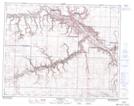
Maps showing Rosedale Station, Alberta
Rosedale Station is a Unincorporated area located in Alberta.
- Latitude: 51° 25' 9'' North (decimal: 51.4191666)
- Longitude: 112° 37' 57'' West (decimal: -112.6324999)
- Topography Feature Category: Unincorporated area
- Geographical Feature: Post Office
- Canadian Province/Territory: Alberta
- Atlas of Canada Locator Map: Rosedale Station
- GPS Coordinate Locator Map: Rosedale Station Lat/Long
Rosedale Station NTS Map Sheets