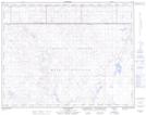
Maps showing Ross Depression, 18,19-4-W4, Alberta
Ross Depression is a Valley located in 18,19-4-W4, Alberta and has an elevation of 660 meters.
- Latitude: 50° 36' 11'' North (decimal: 50.6030555)
- Longitude: 110° 32' 57'' West (decimal: -110.5491667)
- Topography Feature Category: Valley
- Geographical Feature: Depression
- Canadian Province/Territory: Alberta
- Elevation: 660 meters
- Location: 18,19-4-W4
- Atlas of Canada Locator Map: Ross Depression
- GPS Coordinate Locator Map: Ross Depression Lat/Long
Ross Depression NTS Map Sheets