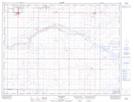
Maps showing Gahern, 30-4-8-W4, Alberta
Gahern is a Unincorporated area located in 30-4-8-W4, Alberta and has an elevation of 893 meters.
- Latitude: 49° 19' 10'' North (decimal: 49.3194444)
- Longitude: 111° 4' 55'' West (decimal: -111.0819443)
- Topography Feature Category: Unincorporated area
- Geographical Feature: Locality
- Canadian Province/Territory: Alberta
- Elevation: 893 meters
- Location: 30-4-8-W4
- Atlas of Canada Locator Map: Gahern
- GPS Coordinate Locator Map: Gahern Lat/Long
Gahern NTS Map Sheets