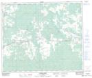
Maps showing Gamma Lake, 15-55-11-W5, Alberta
Gamma Lake is a Lake located in 15-55-11-W5, Alberta and has an elevation of 804 meters.
- Latitude: 53° 44' 52'' North (decimal: 53.7477778)
- Longitude: 115° 33' 44'' West (decimal: -115.5622221)
- Topography Feature Category: Lake
- Geographical Feature: Lake
- Canadian Province/Territory: Alberta
- Elevation: 804 meters
- Location: 15-55-11-W5
- Atlas of Canada Locator Map: Gamma Lake
- GPS Coordinate Locator Map: Gamma Lake Lat/Long
Gamma Lake NTS Map Sheets