Canada Topographic Maps

Garonne Creek Topo Maps

Topography maps and Latitude/Longitude Location

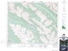
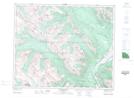
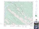
Maps showing Garonne Creek, 46-1-W6, Alberta

Garonne Creek is a River located in 46-1-W6, Alberta and has an elevation of 1902 meters.

  • Latitude: 52° 59' 7'' North   (decimal: 52.9852777)
  • Longitude: 118° 2' 57'' West   (decimal: -118.0491667)
  • Topography Feature Category: River
  • Geographical Feature: Creek
  • Canadian Province/Territory: Alberta
  • Elevation: 1902 meters
  • Location: 46-1-W6
  • Atlas of Canada Locator Map: Garonne Creek
  • GPS Coordinate Locator Map: Garonne Creek Lat/Long

Garonne Creek NTS Map Sheets

083C13 Medicine Lake Topographic Map at 1:50,000 scale

083D16 Jasper Topographic Map at 1:50,000 scale

083E01 Snaring River Topographic Map at 1:50,000 scale

083F04 Miette Topographic Map at 1:50,000 scale

083C Brazeau Lake Topographic Map at 1:250,000 scale

083D Canoe River Topographic Map at 1:250,000 scale

083E Mount Robson Topographic Map at 1:250,000 scale

083F Edson Topographic Map at 1:250,000 scale

 
Buy Topographic Maps DVD
Newsletter Sign-up

Yes, I want to receive map store discounts.


Bookmark and Share