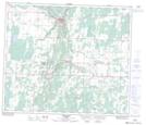
Maps showing George Lake, 64-23-W4, Alberta
George Lake is a Lake located in 64-23-W4, Alberta and has an elevation of 653 meters.
- Latitude: 54° 32' 6'' North (decimal: 54.5350000)
- Longitude: 113° 28' 51'' West (decimal: -113.4808333)
- Topography Feature Category: Lake
- Geographical Feature: Lake
- Canadian Province/Territory: Alberta
- Elevation: 653 meters
- Location: 64-23-W4
- Atlas of Canada Locator Map: George Lake
- GPS Coordinate Locator Map: George Lake Lat/Long
George Lake NTS Map Sheets