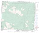
Maps showing George Peak, 58-13-W6, Alberta
George Peak is a Mountain located in 58-13-W6, Alberta.
- Latitude: 54° 2' 42'' North (decimal: 54.0450000)
- Longitude: 119° 55' 13'' West (decimal: -119.9202778)
- Topography Feature Category: Mountain
- Geographical Feature: Peak
- Canadian Province/Territory: Alberta
- Location: 58-13-W6
- Atlas of Canada Locator Map: George Peak
- GPS Coordinate Locator Map: George Peak Lat/Long