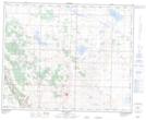
Maps showing Big Valley Creek, 34-21-W4, Alberta
Big Valley Creek is a River located in 34-21-W4, Alberta and has an elevation of 825 meters.
- Latitude: 51° 56' 30'' North (decimal: 51.9416666)
- Longitude: 112° 56' 16'' West (decimal: -112.9377777)
- Topography Feature Category: River
- Geographical Feature: Creek
- Canadian Province/Territory: Alberta
- Elevation: 825 meters
- Location: 34-21-W4
- Atlas of Canada Locator Map: Big Valley Creek
- GPS Coordinate Locator Map: Big Valley Creek Lat/Long
Big Valley Creek NTS Map Sheets