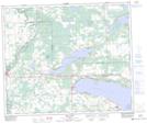
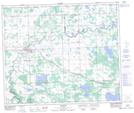
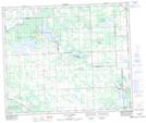
Maps showing Birch Lake, 55-4-W5, Alberta
Birch Lake is a Lake located in 55-4-W5, Alberta and has an elevation of 732 meters.
- Latitude: 53° 45' 25'' North (decimal: 53.7569444)
- Longitude: 114° 31' 45'' West (decimal: -114.5291666)
- Topography Feature Category: Lake
- Geographical Feature: Lake
- Canadian Province/Territory: Alberta
- Elevation: 732 meters
- Location: 55-4-W5
- Atlas of Canada Locator Map: Birch Lake
- GPS Coordinate Locator Map: Birch Lake Lat/Long
Birch Lake NTS Map Sheets