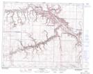
Maps showing Willow Creek, 12-28-19-W4, Alberta
Willow Creek is a Unincorporated area located in 12-28-19-W4, Alberta and has an elevation of 709 meters.
- Latitude: 51° 22' 55'' North (decimal: 51.3819444)
- Longitude: 112° 32' 45'' West (decimal: -112.5458332)
- Topography Feature Category: Unincorporated area
- Geographical Feature: Locality
- Canadian Province/Territory: Alberta
- Elevation: 709 meters
- Location: 12-28-19-W4
- Atlas of Canada Locator Map: Willow Creek
- GPS Coordinate Locator Map: Willow Creek Lat/Long
Willow Creek NTS Map Sheets