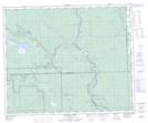
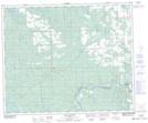
Maps showing Sand Creek, 45-9-W5, Alberta
Sand Creek is a River located in 45-9-W5, Alberta and has an elevation of 964 meters.
- Latitude: 52° 55' 47'' North (decimal: 52.9297222)
- Longitude: 115° 13' 23'' West (decimal: -115.2230555)
- Topography Feature Category: River
- Geographical Feature: Creek
- Canadian Province/Territory: Alberta
- Elevation: 964 meters
- Location: 45-9-W5
- Atlas of Canada Locator Map: Sand Creek
- GPS Coordinate Locator Map: Sand Creek Lat/Long
Sand Creek NTS Map Sheets