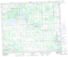
Maps showing Sandy Beach, 34,35-55-1-W5; 2,3-56-1-W5, Alberta
Sandy Beach is a Village located in 34,35-55-1-W5; 2,3-56-1-W5, Alberta and has an elevation of 702 meters.
- Latitude: 53° 48' 28'' North (decimal: 53.8077777)
- Longitude: 114° 2' 31'' West (decimal: -114.0419444)
- Topography Feature Category: Village
- Geographical Feature: Summer Village
- Canadian Province/Territory: Alberta
- Elevation: 702 meters
- Location: 34,35-55-1-W5; 2,3-56-1-W5
- Atlas of Canada Locator Map: Sandy Beach
- GPS Coordinate Locator Map: Sandy Beach Lat/Long
Sandy Beach NTS Map Sheets