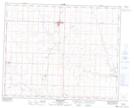
Maps showing Ghost Pine Creek, 5-32-22-W4, Alberta
Ghost Pine Creek is a Unincorporated area located in 5-32-22-W4, Alberta and has an elevation of 830 meters.
- Latitude: 51° 42' 28'' North (decimal: 51.7077778)
- Longitude: 113° 4' 34'' West (decimal: -113.0761111)
- Topography Feature Category: Unincorporated area
- Geographical Feature: Locality
- Canadian Province/Territory: Alberta
- Elevation: 830 meters
- Location: 5-32-22-W4
- Atlas of Canada Locator Map: Ghost Pine Creek
- GPS Coordinate Locator Map: Ghost Pine Creek Lat/Long
Ghost Pine Creek NTS Map Sheets