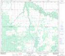
Maps showing Gilmore Lake, 2-73-22-W5, Alberta
Gilmore Lake is a Lake located in 2-73-22-W5, Alberta and has an elevation of 645 meters.
- Latitude: 55° 17' 38'' North (decimal: 55.2938889)
- Longitude: 117° 16' 39'' West (decimal: -117.2775000)
- Topography Feature Category: Lake
- Geographical Feature: Lake
- Canadian Province/Territory: Alberta
- Elevation: 645 meters
- Location: 2-73-22-W5
- Atlas of Canada Locator Map: Gilmore Lake
- GPS Coordinate Locator Map: Gilmore Lake Lat/Long
Gilmore Lake NTS Map Sheets