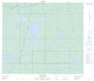
Maps showing Glover Lake, 75-9-W4, Alberta
Glover Lake is a Lake located in 75-9-W4, Alberta and has an elevation of 659 meters.
- Latitude: 55° 29' 30'' North (decimal: 55.4916666)
- Longitude: 111° 19' 2'' West (decimal: -111.3172222)
- Topography Feature Category: Lake
- Geographical Feature: Lake
- Canadian Province/Territory: Alberta
- Elevation: 659 meters
- Location: 75-9-W4
- Atlas of Canada Locator Map: Glover Lake
- GPS Coordinate Locator Map: Glover Lake Lat/Long
Glover Lake NTS Map Sheets