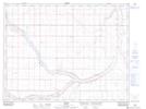
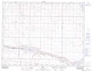
Maps showing Forty Mile Coulée, 7-10-W4, Alberta
Forty Mile Coulée is a Valley located in 7-10-W4, Alberta and has an elevation of 790 meters.
- Latitude: 49° 33' 17'' North (decimal: 49.5546389)
- Longitude: 111° 12' 21'' West (decimal: -111.2057500)
- Topography Feature Category: Valley
- Geographical Feature: Coulée
- Canadian Province/Territory: Alberta
- Elevation: 790 meters
- Location: 7-10-W4
- Atlas of Canada Locator Map: Forty Mile Coulée
- GPS Coordinate Locator Map: Forty Mile Coulée Lat/Long
Forty Mile Coulée NTS Map Sheets