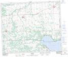
Maps showing Golden Days, 15-47-1-W5, Alberta
Golden Days is a Village located in 15-47-1-W5, Alberta and has an elevation of 854 meters.
- Latitude: 53° 3' 28'' North (decimal: 53.0577777)
- Longitude: 114° 3' 57'' West (decimal: -114.0658332)
- Topography Feature Category: Village
- Geographical Feature: Summer Village
- Canadian Province/Territory: Alberta
- Elevation: 854 meters
- Location: 15-47-1-W5
- Atlas of Canada Locator Map: Golden Days
- GPS Coordinate Locator Map: Golden Days Lat/Long
Golden Days NTS Map Sheets