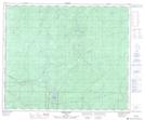
Maps showing Maria Creek, 54-27-W5, Alberta
Maria Creek is a River located in 54-27-W5, Alberta and has an elevation of 1245 meters.
- Latitude: 53° 42' 21'' North (decimal: 53.7058333)
- Longitude: 117° 51' 13'' West (decimal: -117.8536111)
- Topography Feature Category: River
- Geographical Feature: Creek
- Canadian Province/Territory: Alberta
- Elevation: 1245 meters
- Location: 54-27-W5
- Atlas of Canada Locator Map: Maria Creek
- GPS Coordinate Locator Map: Maria Creek Lat/Long