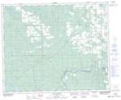
Maps showing Blue Rapids, 47-9-W5, Alberta
Blue Rapids is a Rapids located in 47-9-W5, Alberta and has an elevation of 818 meters.
- Latitude: 53° 3' 12'' North (decimal: 53.0533333)
- Longitude: 115° 12' 26'' West (decimal: -115.2072221)
- Topography Feature Category: Rapids
- Geographical Feature: Rapids
- Canadian Province/Territory: Alberta
- Elevation: 818 meters
- Location: 47-9-W5
- Atlas of Canada Locator Map: Blue Rapids
- GPS Coordinate Locator Map: Blue Rapids Lat/Long
Blue Rapids NTS Map Sheets