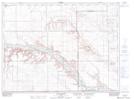
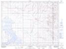
Maps showing Bond Coulee, 34-3-7-W4, Alberta
Bond Coulee is a Valley located in 34-3-7-W4, Alberta and has an elevation of 860 meters.
- Latitude: 49° 15' 34'' North (decimal: 49.2594444)
- Longitude: 110° 51' 46'' West (decimal: -110.8627778)
- Topography Feature Category: Valley
- Geographical Feature: Coulee
- Canadian Province/Territory: Alberta
- Elevation: 860 meters
- Location: 34-3-7-W4
- Atlas of Canada Locator Map: Bond Coulee
- GPS Coordinate Locator Map: Bond Coulee Lat/Long
Bond Coulee NTS Map Sheets