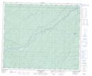
Maps showing Botten, 24-60-5-W6, Alberta
Botten is a Unincorporated area located in 24-60-5-W6, Alberta and has an elevation of 865 meters.
- Latitude: 54° 11' 47'' North (decimal: 54.1963889)
- Longitude: 118° 36' 40'' West (decimal: -118.6111111)
- Topography Feature Category: Unincorporated area
- Geographical Feature: Railway Point
- Canadian Province/Territory: Alberta
- Elevation: 865 meters
- Location: 24-60-5-W6
- Atlas of Canada Locator Map: Botten
- GPS Coordinate Locator Map: Botten Lat/Long
Botten NTS Map Sheets