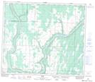
Maps showing Sawdy, 2-68-23-W4, Alberta
Sawdy is a Unincorporated area located in 2-68-23-W4, Alberta and has an elevation of 619 meters.
- Latitude: 54° 51' 0'' North (decimal: 54.8500000)
- Longitude: 113° 23' 47'' West (decimal: -113.3963889)
- Topography Feature Category: Unincorporated area
- Geographical Feature: Former Post Office
- Canadian Province/Territory: Alberta
- Elevation: 619 meters
- Location: 2-68-23-W4
- Atlas of Canada Locator Map: Sawdy
- GPS Coordinate Locator Map: Sawdy Lat/Long