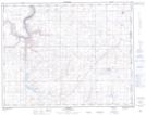
Maps showing Schuler, 9-16-1-W4, Alberta
Schuler is a Unincorporated area located in 9-16-1-W4, Alberta and has an elevation of 802 meters.
- Latitude: 50° 19' 53'' North (decimal: 50.3313889)
- Longitude: 110° 6' 27'' West (decimal: -110.1075000)
- Topography Feature Category: Unincorporated area
- Geographical Feature: Hamlet
- Canadian Province/Territory: Alberta
- Elevation: 802 meters
- Location: 9-16-1-W4
- Atlas of Canada Locator Map: Schuler
- GPS Coordinate Locator Map: Schuler Lat/Long