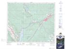
Maps showing Scovil Creek, 50-27-W5, Alberta
Scovil Creek is a River located in 50-27-W5, Alberta and has an elevation of 1195 meters.
- Latitude: 53° 19' 16'' North (decimal: 53.3211111)
- Longitude: 117° 50' 57'' West (decimal: -117.8491666)
- Topography Feature Category: River
- Geographical Feature: Creek
- Canadian Province/Territory: Alberta
- Elevation: 1195 meters
- Location: 50-27-W5
- Atlas of Canada Locator Map: Scovil Creek
- GPS Coordinate Locator Map: Scovil Creek Lat/Long