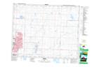
Maps showing The Sharp Hill, 26-29-W4, Alberta
The Sharp Hill is a Mountain located in 26-29-W4, Alberta and has an elevation of 1095 meters.
- Latitude: 51° 14' 41'' North (decimal: 51.2447222)
- Longitude: 113° 58' 53'' West (decimal: -113.9813888)
- Topography Feature Category: Mountain
- Geographical Feature: Hill
- Canadian Province/Territory: Alberta
- Elevation: 1095 meters
- Location: 26-29-W4
- Atlas of Canada Locator Map: The Sharp Hill
- GPS Coordinate Locator Map: The Sharp Hill Lat/Long