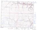
Maps showing Sharples, 17-29-22-W4, Alberta
Sharples is a Unincorporated area located in 17-29-22-W4, Alberta and has an elevation of 770 meters.
- Latitude: 51° 28' 42'' North (decimal: 51.4783333)
- Longitude: 113° 3' 50'' West (decimal: -113.0638888)
- Topography Feature Category: Unincorporated area
- Geographical Feature: Locality
- Canadian Province/Territory: Alberta
- Elevation: 770 meters
- Location: 17-29-22-W4
- Atlas of Canada Locator Map: Sharples
- GPS Coordinate Locator Map: Sharples Lat/Long