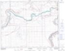
Maps showing Sharrow, 35-22-2-W4, Alberta
Sharrow is a Unincorporated area located in 35-22-2-W4, Alberta.
- Latitude: 50° 54' 44'' North (decimal: 50.9122222)
- Longitude: 110° 10' 36'' West (decimal: -110.1766667)
- Topography Feature Category: Unincorporated area
- Geographical Feature: Locality
- Canadian Province/Territory: Alberta
- Location: 35-22-2-W4
- Atlas of Canada Locator Map: Sharrow
- GPS Coordinate Locator Map: Sharrow Lat/Long
Sharrow NTS Map Sheets