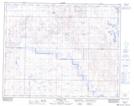
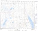
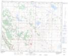
Maps showing Gough Lake, 35-18-W4, Alberta
Gough Lake is a Lake located in 35-18-W4, Alberta and has an elevation of 824 meters.
- Latitude: 52° 2' 56'' North (decimal: 52.0488889)
- Longitude: 112° 27' 42'' West (decimal: -112.4616666)
- Topography Feature Category: Lake
- Geographical Feature: Lake
- Canadian Province/Territory: Alberta
- Elevation: 824 meters
- Location: 35-18-W4
- Atlas of Canada Locator Map: Gough Lake
- GPS Coordinate Locator Map: Gough Lake Lat/Long
Gough Lake NTS Map Sheets