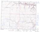
Maps showing Grainger, 20-29-24-W4, Alberta
Grainger is a Unincorporated area located in 20-29-24-W4, Alberta and has an elevation of 850 meters.
- Latitude: 51° 29' 30'' North (decimal: 51.4916666)
- Longitude: 113° 19' 57'' West (decimal: -113.3324999)
- Topography Feature Category: Unincorporated area
- Geographical Feature: Locality
- Canadian Province/Territory: Alberta
- Elevation: 850 meters
- Location: 20-29-24-W4
- Atlas of Canada Locator Map: Grainger
- GPS Coordinate Locator Map: Grainger Lat/Long