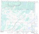
Maps showing Grassland, 28-67-18-W4, Alberta
Grassland is a Unincorporated area located in 28-67-18-W4, Alberta and has an elevation of 584 meters.
- Latitude: 54° 49' 12'' North (decimal: 54.8200000)
- Longitude: 112° 41' 14'' West (decimal: -112.6872221)
- Topography Feature Category: Unincorporated area
- Geographical Feature: Hamlet
- Canadian Province/Territory: Alberta
- Elevation: 584 meters
- Location: 28-67-18-W4
- Atlas of Canada Locator Map: Grassland
- GPS Coordinate Locator Map: Grassland Lat/Long
Grassland NTS Map Sheets