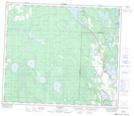
Maps showing Lake Gray, 67-26-W4, Alberta
Lake Gray is a Lake located in 67-26-W4, Alberta and has an elevation of 672 meters.
- Latitude: 54° 50' 19'' North (decimal: 54.8386110)
- Longitude: 113° 57' 32'' West (decimal: -113.9588888)
- Topography Feature Category: Lake
- Geographical Feature: Lake
- Canadian Province/Territory: Alberta
- Elevation: 672 meters
- Location: 67-26-W4
- Atlas of Canada Locator Map: Lake Gray
- GPS Coordinate Locator Map: Lake Gray Lat/Long