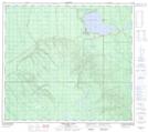
Maps showing Gregoire Lake Provincial Park, 86-8-W4, Alberta
Gregoire Lake Provincial Park is a Conservation area located in 86-8-W4, Alberta and has an elevation of 490 meters.
- Latitude: 56° 29' 6'' North (decimal: 56.4850000)
- Longitude: 111° 10' 58'' West (decimal: -111.1827778)
- Topography Feature Category: Conservation area
- Geographical Feature: Provincial Park
- Canadian Province/Territory: Alberta
- Elevation: 490 meters
- Location: 86-8-W4
- Atlas of Canada Locator Map: Gregoire Lake Provincial Park
- GPS Coordinate Locator Map: Gregoire Lake Provincial Park Lat/Long
Gregoire Lake Provincial Park NTS Map Sheets