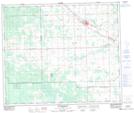
Maps showing Mayerthorpe, 28-57-8-W5, Alberta
Mayerthorpe is a Town located in 28-57-8-W5, Alberta and has an elevation of 717 meters.
- Latitude: 53° 57' 17'' North (decimal: 53.9547222)
- Longitude: 115° 8' 17'' West (decimal: -115.1380556)
- Topography Feature Category: Town
- Geographical Feature: Town
- Canadian Province/Territory: Alberta
- Elevation: 717 meters
- Location: 28-57-8-W5
- Atlas of Canada Locator Map: Mayerthorpe
- GPS Coordinate Locator Map: Mayerthorpe Lat/Long
Mayerthorpe NTS Map Sheets