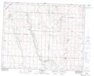
Maps showing Mayton, 23-33-27-W4, Alberta
Mayton is a Unincorporated area located in 23-33-27-W4, Alberta and has an elevation of 969 meters.
- Latitude: 51° 50' 19'' North (decimal: 51.8386111)
- Longitude: 113° 44' 11'' West (decimal: -113.7363889)
- Topography Feature Category: Unincorporated area
- Geographical Feature: Locality
- Canadian Province/Territory: Alberta
- Elevation: 969 meters
- Location: 23-33-27-W4
- Atlas of Canada Locator Map: Mayton
- GPS Coordinate Locator Map: Mayton Lat/Long
Mayton NTS Map Sheets