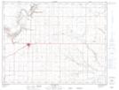
Maps showing Bow Island, 36-10-11-W4, Alberta
Bow Island is a Town located in 36-10-11-W4, Alberta and has an elevation of 796 meters.
- Latitude: 49° 52' 2'' North (decimal: 49.8672221)
- Longitude: 111° 22' 44'' West (decimal: -111.3788888)
- Topography Feature Category: Town
- Geographical Feature: Town
- Canadian Province/Territory: Alberta
- Elevation: 796 meters
- Location: 36-10-11-W4
- Atlas of Canada Locator Map: Bow Island
- GPS Coordinate Locator Map: Bow Island Lat/Long
Bow Island NTS Map Sheets