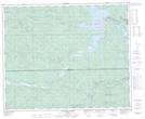
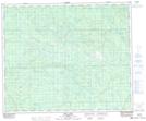
Maps showing Brazeau Reservoir, 24-46-12-W5, Alberta
Brazeau Reservoir is a Lake located in 24-46-12-W5, Alberta and has an elevation of 927 meters.
- Latitude: 52° 56' 53'' North (decimal: 52.9480555)
- Longitude: 115° 38' 21'' West (decimal: -115.6391666)
- Topography Feature Category: Lake
- Geographical Feature: Reservoir
- Canadian Province/Territory: Alberta
- Elevation: 927 meters
- Location: 24-46-12-W5
- Atlas of Canada Locator Map: Brazeau Reservoir
- GPS Coordinate Locator Map: Brazeau Reservoir Lat/Long
Brazeau Reservoir NTS Map Sheets