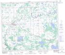
Maps showing Brock Lake, 56-6-W5, Alberta
Brock Lake is a Lake located in 56-6-W5, Alberta and has an elevation of 720 meters.
- Latitude: 53° 48' 51'' North (decimal: 53.8141666)
- Longitude: 114° 50' 36'' West (decimal: -114.8433333)
- Topography Feature Category: Lake
- Geographical Feature: Lake
- Canadian Province/Territory: Alberta
- Elevation: 720 meters
- Location: 56-6-W5
- Atlas of Canada Locator Map: Brock Lake
- GPS Coordinate Locator Map: Brock Lake Lat/Long
Brock Lake NTS Map Sheets