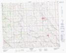
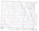
Maps showing Sheep Coulee, 29-29-W4, Alberta
Sheep Coulee is a Valley located in 29-29-W4, Alberta and has an elevation of 1021 meters.
- Latitude: 51° 31' 50'' North (decimal: 51.5305830)
- Longitude: 113° 56' 0'' West (decimal: -113.9333889)
- Topography Feature Category: Valley
- Geographical Feature: Coulee
- Canadian Province/Territory: Alberta
- Elevation: 1021 meters
- Location: 29-29-W4
- Atlas of Canada Locator Map: Sheep Coulee
- GPS Coordinate Locator Map: Sheep Coulee Lat/Long
Sheep Coulee NTS Map Sheets