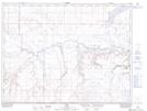
Maps showing Smith Coulée, 3-11-W4, Alberta
Smith Coulée is a Valley located in 3-11-W4, Alberta and has an elevation of 961 meters.
- Latitude: 49° 8' 44'' North (decimal: 49.1455555)
- Longitude: 111° 18' 28'' West (decimal: -111.3077778)
- Topography Feature Category: Valley
- Geographical Feature: Coulée
- Canadian Province/Territory: Alberta
- Elevation: 961 meters
- Location: 3-11-W4
- Atlas of Canada Locator Map: Smith Coulée
- GPS Coordinate Locator Map: Smith Coulée Lat/Long