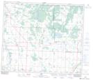
Maps showing Halcreek, 4-62-25-W4, Alberta
Halcreek is a Unincorporated area located in 4-62-25-W4, Alberta and has an elevation of 641 meters.
- Latitude: 54° 19' 38'' North (decimal: 54.3272222)
- Longitude: 113° 41' 25'' West (decimal: -113.6902778)
- Topography Feature Category: Unincorporated area
- Geographical Feature: Locality
- Canadian Province/Territory: Alberta
- Elevation: 641 meters
- Location: 4-62-25-W4
- Atlas of Canada Locator Map: Halcreek
- GPS Coordinate Locator Map: Halcreek Lat/Long