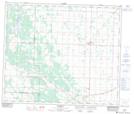
Maps showing Halfway Lake, 25-59-24-W4, Alberta
Halfway Lake is a Unincorporated area located in 25-59-24-W4, Alberta and has an elevation of 659 meters.
- Latitude: 54° 7' 38'' North (decimal: 54.1272222)
- Longitude: 113° 27' 50'' West (decimal: -113.4638888)
- Topography Feature Category: Unincorporated area
- Geographical Feature: Locality
- Canadian Province/Territory: Alberta
- Elevation: 659 meters
- Location: 25-59-24-W4
- Atlas of Canada Locator Map: Halfway Lake
- GPS Coordinate Locator Map: Halfway Lake Lat/Long