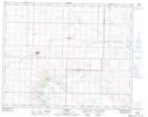
Maps showing Handhills Creek, 29-16-W4, Alberta
Handhills Creek is a River located in 29-16-W4, Alberta.
- Latitude: 51° 31' 21'' North (decimal: 51.5225000)
- Longitude: 112° 9' 24'' West (decimal: -112.1566667)
- Topography Feature Category: River
- Geographical Feature: Creek
- Canadian Province/Territory: Alberta
- Location: 29-16-W4
- Atlas of Canada Locator Map: Handhills Creek
- GPS Coordinate Locator Map: Handhills Creek Lat/Long
Handhills Creek NTS Map Sheets