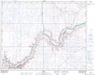
Maps showing Halsbury, 18-21-8-W4, Alberta
Halsbury is a Unincorporated area located in 18-21-8-W4, Alberta.
- Latitude: 50° 47' North (decimal: 50.7833000)
- Longitude: 111° 7' West (decimal: -111.1166999)
- Topography Feature Category: Unincorporated area
- Geographical Feature: Locality
- Canadian Province/Territory: Alberta
- Location: 18-21-8-W4
- Atlas of Canada Locator Map: Halsbury
- GPS Coordinate Locator Map: Halsbury Lat/Long