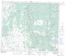
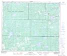
Maps showing Hanmore Lake, 61-17,18-W4, Alberta
Hanmore Lake is a Lake located in 61-17,18-W4, Alberta and has an elevation of 670 meters.
- Latitude: 54° 17' 45'' North (decimal: 54.2958333)
- Longitude: 112° 31' 40'' West (decimal: -112.5277778)
- Topography Feature Category: Lake
- Geographical Feature: Lake
- Canadian Province/Territory: Alberta
- Elevation: 670 meters
- Location: 61-17,18-W4
- Atlas of Canada Locator Map: Hanmore Lake
- GPS Coordinate Locator Map: Hanmore Lake Lat/Long
Hanmore Lake NTS Map Sheets