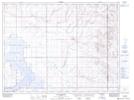
Maps showing Hanson Creek, 20-4-6-W4, Alberta
Hanson Creek is a River located in 20-4-6-W4, Alberta and has an elevation of 884 meters.
- Latitude: 49° 18' 36'' North (decimal: 49.3099999)
- Longitude: 110° 46' 33'' West (decimal: -110.7758333)
- Topography Feature Category: River
- Geographical Feature: Creek
- Canadian Province/Territory: Alberta
- Elevation: 884 meters
- Location: 20-4-6-W4
- Atlas of Canada Locator Map: Hanson Creek
- GPS Coordinate Locator Map: Hanson Creek Lat/Long
Hanson Creek NTS Map Sheets